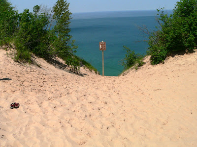
The town sponsored a Sunday afternoon fish fry as part of the fund raising to dredge their harbor. The harbor was filling up with sand. While we were touring the fall ( later photos ) we encountered the Michigan Senator Tom Casperson that sponsored a bill that gave Grand Marais 4 million to fix the harbor problems so I guess our fish fry donation didn't save the harbor after all. We did enjoy the meal ( lake trout ) on the waterfront as the food was good and the weather just perfect
Tuesday, June 28, 2011
Monday, June 27, 2011
Sunset on Lake Superior
We have been treated to some great sunsets on Lake Superior. This photo was improved on when a fishing boat passed by the setting sun . Sunset in this part of Michigan is usually about 9:45PM.
Pasties are Michigan UP's "Soul Food"
They also serve Green Mountain's Keurig Coffee!
The recipe so you can give them a try. Click on the photo to enlarge....
Now don't these look delicious! Pasties are a meal in your hand.
Pictured Rocks National Lakeshoe-Grand Marais Entrance
Visitor Center at Grand Marais end of route H58. The road is now paved all the way through the Lakeshore.
Log Slide Overlook is an easy walk from the picnic area. Accounts tell of logs sent down the dry log chute generating enough friction to cause the chute to catch fire.
View from the top of the log chute...there are people down there....
Grand Sable Dunes as seen from the log chute.
Sable Falls in Pictured Rocks National Lakeshore near Grand Marais, MI on Lake Superior.
Sunday, June 26, 2011
Photos of Grand Marais, MI
The harbor at Grand Marais is safe and protected....very important in the settling of the village.
Whitefish Point Lighthouse, Paradise, MI
From the wreck of the schooner Invincible in 1816 to the sinking of the Edmund Fitzgerald in 1975, the waters off Whitefish Point have always been one of the most dangerous sections of Lake Superior and is know a the "Graveyard" of the Great Lakes.
Whitefish Point today, tho remote, is very interesting with the Great Lakes Shipwreck Museum, lighthouse, keepers's quarters, a gift shop and store. From the lengthy shoreline on a clear day you can see the coastline of Ontario.
Tahquamenon Falls State Park
Tahquamenon Falls, located in Michigan's Upper Peninsula, is the second mightiest waterfall east of the Mississippi. The Falls are nestled among the largest stand of old growth trees in Michigan.
Grand Marais, Woodland Park
We are staying in Woodland Park, which is a municipally owned campground in Grand Marais, MI. The CG sits on a bluff overlooking Lake Superior.
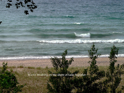
The park has three stairways leading down to the Lake Superior shoreline. The first night we were here we were in a storm pattern and the waves were in 3-4 ft range.
That is us facing the shoreline and we can see Lake Superior from our driver's window through the trees.
The park has three stairways leading down to the Lake Superior shoreline. The first night we were here we were in a storm pattern and the waves were in 3-4 ft range.
That is us facing the shoreline and we can see Lake Superior from our driver's window through the trees.
Thursday, June 23, 2011
Point Iroquois Lighthouse
Point Iroquois Light Station is located along the Lake Superior shore on the Whitefish Bay Scenic Byway west of Sault Ste Marie, MI.
Why the name "Point Iroquois?" In 1662 a group of Iroquois traveled about 400 miles by canoe and foot from their homeland in western New York to the shores of Lake Superior. The local Chippewa defeated them in a battle fought near what is now called Point Iroquois.
Step back in time to the 1950's. The assistant keeper's apartment has been restored to the way it looked in the early 1950.
A fog and rainy day at point Iroquois. The purpose of the light station was to guide freighters safely between the open waters of Whitefish Bay and the St. Mary's River. Even with the aid of the light and fog horn at Point Iroquois the passage was very dangerous.
Tuesday, June 21, 2011
The Sault Ste Marie ( Soo ) Locks
Since it was a rainy, blustery day we decided to go out to lunch and ended up at the Lock View Restaurant in downtown Sault Ste. Marie. Jan and I had a front row table to see the Frontenac ( an ore carrier ) proceed through the Soo Lock. This lock system was built at the "rapids of Saint Mary ( Sault Ste Marie ) and eliminated a lengthy portage around the rapids.
The army Corps of Engineers has a facility complete with armed guards to control the visitors to the locks but it's all free.
We enjoyed the lunch and the chance to see how these ships proceed from Lake Huron to Lake Superior which approximately 20' higher than Huron.
Subscribe to:
Posts (Atom)